|
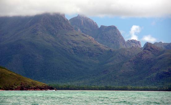
A world-famous multi-day walking track wends its way down the east coast of the island. People book and travel from many countries just to do this walk. The view we had of the mountains towering more than 1000m over the beach was one they wouldn’t see – you really need to view the coastline from the ocean to fully appreciate its scale. |
|
HEAVENLY HINCHINBROOK...continued |
|
BACK to Masala Home Page |
|
BACK to Masala Cruise Log |
|
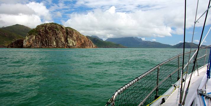
Above: Masala approaching Hillock Point on the exposed east coast of Hinchinbrook Island |
|
As we approached Zoe Bay, the spectacular granite peak called The Thumb had its summit poked into the clouds. The mountains are so high that they regularly generate their own weather – it is not uncommon for the peaks to be shrouded in a white shawl while all around the sky is clear blue. |
|
Most people sail up the Hinchinbrook Channel, between Hinchinbrook Island and the mainland, because the waterways are sheltered and the scenery is good – but not to the same standard as the outside. The challenges of Zoe Bay soon became obvious after we anchored in the late morning – despite the calm weather, a 1.5m swell was rolling into the bay and breaking on the hard sand of the gradually shelving beach. Getting off the boat and ashore, and back again, would not be without its thrills and spills.
We knew that at each end of the bay were creeks that harboured crocodiles. We were close to the southern |
|
Left: The Thumb, with its thumbnail in the clouds, towers more than 1000 metres over Zoe Bay |